Sandy Woolley's Balwyn to Bright Gravel Adventure
Gravel Balwyn to Bright
The idea came from a mate of my youngest. He set off early Jan on a solo
venture from Sydney to Byron of self-discovery. He had done no training (aside
from some social drinking and smoking) and had a hybrid! So, what was holding
me back? With a barely used gravel bike, no job to get in the way and a weekend
in Bright already planned, I decided I would set off the week before. As hard core
as that sounds, one thing was very clear in my mind; it was credit card camping
- no lugging a tent, sleeping bag or stove. If I was to be sweating it out
during the day, I would be kicking back at night - shower, nice food and a real
bed! Pleased with myself for coming up with the idea, I proceeded to do no
planning. How hard could it be right? A week before departure, I realised some
planning might be wise. How do I plan a course that keeps me off main roads?
What is realistic distance for each day? Will I be ok on my own? While I
wouldn’t need camping stuff, what would I need to take?
For those time poor: scroll to end for key lessons that may help you with your next Gravel Grinders Melbourne adventure.
The Route
Thanks to a blog by Gareth
Thomas on his recent two-day adventure, I got some great tips that helped
greatly. First and foremost, I ensured I didn’t overestimate what could be done
in a day. Gravel riding is not like road riding! Gareth had done two massive days
and emptied his much bigger tank than mine. With so many navigation platforms
available, I wasn’t sure where to start. I hadn’t ever bothered with navigation
on my Garmin before- I mean how do you get lost going to Mordialloc or the
boulevards? A quick call to Manny opened up a whole world of functionality in
Strava Premium I didn’t know about. I started to much around with creating a
course and perhaps got to the Burke Road pedestrian crossing in my mapping when
a link came through from Manny of a complete course! 7000m elevation and just
over 400ks with stop overs in some great regional towns. We don’t call him
"Rainman" for nothing! Challenge with the one big blob course though
was seeing what the daily breakdown would be. Easy to fix I thought; edit it into
daily courses right!? Not so easy. Another call to the Strava helpdesk (i.e.,
Manny). “Yeah; not so easy. Probably have to just create new maps by day.” “Thanks
Manny will give it a go”. 1. Open browser. 2. Log on to Strava - shit; which
email and password combo for that? “Ping, ping, ping”. “Ring, ring, ring”.
“Sandy; it’s Manny - I have just sent through courses for each day (2 options
for Day 4). You should be able to see them on your Strava app on your phone.
Save them there and then they will load strain onto your Garmin.” Wtf! That was
easier for me than I thought! The power of harnessing the knowledge of your
network! I practised using the map on the Garmin by riding the day 1 course several
times.
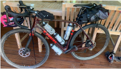
Bike Prep and Gear Check
No Mates?
Being in between jobs (and loving it!), and knowing most others aren’t,
I had every expectation that I would be solo. I was thrilled though to have one
of my bayside “Hammer-Nail” riding mates in Rick Moscati commit just days out
from my departure. To that point, my family had thought I was doing it with
others and hadn’t appreciated how isolated the course would be at times. I too
was glad to have some company if for no other reason than safety.
Day 1 - Home to Healesville- 67km and 1149m elevation
What began as a personal adventure, piqued the interest of many. Unable
to join for the week, a few were to at least ride with me Day 1. Injuries to a
few just before I left scuppered their ideas. Their injuries while gravelling
also served as a stark reminder to me how easy a fall can happen and the risk
that such a trip can expose you to. So, it was just me and Rick and Andrew “Genghis”
Hahn for the day. They arrived at my place around 8am. Somehow Andrew managed
to get a pinch flat on his way over! The ride out was along many familiar
trails. So much great riverside country so close to home! Still, there was
plenty of climbing and new trails out to Yarra Glen. Hot and humid, we were
glad to have the last 10ks to Healesville on paved roads. Checked into the
Healesville Hotel and a great meal at Herd joined by my (supportive, forgiving
and understanding) wife Mary Louise.
Day 2 - Healesville to Alexandra- 83km and 1833m elevation

Averages can be so meaningless.
Stanley Track was an unrideable beast. In the hot afternoon sun, we walked,
sweltered and dragged our way up. Having got to the top we then skidded, bone
rattled and roared our way down and into Alexandra. We knew day 2 was going to
be challenging; and so it was! But it delivered in spades the adventure and
challenge this trip was all about. Wouldn’t have changed anything. The ham and
salad roll at Kazzas Diner was good. Shame we missed her morning Zumba class!
The Alexandra Motel had a salt pool so was our home for the night. A beer,
Chicken schnitzel and a bottle of Sangiovese hardly touched the sides. It did
make it easier to reflect on the day and share some deep life insights none of
which solved anything (but didn’t really need to either!).
Day 3 - Alexandra to Mansfield 77km and 500m elevation
 |
| Crossing Lake Eildon at Bonnie Doon |
Day 4 - Mansfield to Whitfield Option 1 – 82ks and 1463m or Option 2 Mansfield
to Whitfield Option 2 – 56km and 918m?
First decision was which course option? Option 1 had the same stats as
Day 2 - 80ks and 1800m elevation. Screw that! Option 2 it was: 55k and 1000m
elevation and only 20% unpaved. It was a good call. Some cumulative day fatigue
was with me and there was more than enough to keep the day challenging. For the
first 35km, it had a little bit of everything and was really enjoyable. Good
course design Manny! “Turn right”. “Looks a bit steep Rick - we in”. “Let’s do
it Sandy”. Wet, slippery and with all this anti-erosion humps was an indication
of just how steep. “It should flatten a bit as we get further down” I surmised.
Wrong! Skidding, sliding and generally feeling out of control, this was
technical, surprisingly energy sapping and challenging. But at the same time
really good fun! Nice one Manny! Why is Cam (Edwards) trying to call us now!?
Feck; we are busy!
Sandy: “Hey Cam, what’s up?”
Cam: “Don’t go down there; it is brutal! I walked up it a couple of
years ago.”
Sandy “Aha: thanks for letting us know”.
We get down safely and finished with a challenging little river crossing
which gave Rick some superhuman power for the rest of the ride (or perhaps the
water just shorted his power meter?).

 |
| Rick hits the water |
Arrived in Whitfield nice and early. What a lovely way to roll into the beautiful King-Valley. A quick stop into well-known Pizzini Winery, plenty of Sangiovese to be had but no real food. The Strava messages started to ping. “The pizza at Dal-Zotto is amazing”. A few more km’s up the road… but once again, Sangiovese and Nebbiolo in abundance but restaurant closed for renovations … in January no less! Back up the road and to the Cheshunt general store for what Michael Dal-Zotto says is the best steak sandwich and burger in southern Victoria … don’t know if we were just super hungry but we’d tend to agree. Whitfield Hotel Motel was home for the night. Great beer garden and restaurant (pasta was our choice that night) and extensive choice of #Pizzini wines (now why is that?).
Day 5 - Whitfield to Myrtleford 55km and 1100m elevation
This day was mostly unpaved and took us on some varied gravel surfaces -
loose and big rocked, hard packed red clay, dusty gravel. Descending was mostly
fun, but almost as tiring as going uphill. Really easy to break concentration
and lose rhythm…last thing we needed was a big stack on the last day! Only one
flat for the entire trip. A simple pinch
flat which wouldn’t seal with our whiz bang tubeless plug kit… so old school
tune it was. Whilst Rick was being lazy and running high tyre pressures to save
watts, I needed more comfort for my ass and in hindsight my pressure was a bit
too low! Is that why he beat me up all those hills? We cruised into Myrtleford
around 11am, had some lunch and then started the really easy (boring and arse
numbing) trail to get Rick on a train home from Wangaratta. I stayed with him
for 20kms before turning back (and so I would click over 100km for the day -
but who really cares right!?).
Back in Myrtleford I thought I would get a bit more dressed up than my
sports shorts and mtb shoe and got some very classy shorts, thongs and t-shirt
from one of the many oppies. Checked into newly renovated centrally located
Myrtleford Hotel Motel. Finally got that chicken Parma and chips I had been avoiding
all week. Afternoon snooze after 350 gravel kms for the week; feeling a tad
weary.
Day 6 - Myrtleford to Bright 30km and bugger all elevation
Met by Stan, Jack and Darko for this last day cruise for planned
Gruppetto weekend in the hills. Original plan was to ride the rail trail there.
We came up with a better plan - drive there and then go for a ride around some
of the Bright trails. Overall, a great
adventure of self-indulgence and something different to the road riding I love.
Some key lessons
1. Course design on Strava is a great feature but not intuitive. Thanks
Manny for your help! Let us know your tuition fees and let’s get a course done.
Don’t get too stressed when you think you’re following the map and your Garmin
beeps at you repeatedly... “U-turn, U-turn”. turns out the GPS isn’t that
accurate on some of those unknown 4WD tracks.
2. Gravelling is bloody slow, or it was for us! Base your planning on
doing 15km/h. Even on the rail trail day when we could do some sections at 40km/h,
our average was just over 20km/h. You will invariably burn time stopping to
check course navigation and even doing some back tracking. It all adds up!
3. Try and plan your days around a mid-ride stop in a country town for
some country hospitality and a chance to eat some real food… how I dislike
those gels.
4. Get out there, solo or with your mates and have a go. It’s an
absolute blast. Everyone talks about riding in Europe and yep that’s great fun
too, but there’s so many amazing opportunities just a few km’s down the road.
Selfrighteouscyclist’s
note
Thanks to Sandy
Woolley for capturing the essence of gravel riding. It’s not about the destination,
but the journey one took to get there which leaves you with a lifetime of memories and experiences. This blog was first posted on the Connected Cycling Facebook page, which is one of Sandy's side interests. I'd urge you to subscribe.


Comments
Post a Comment